In an era of rapid technological growth, certain technologies, such as artificial intelligence and the internet of things, have received mass adoption and become household names. One up-and-coming technology that has the potential to reach that level of adoption is LiDAR.
WHAT IS LIDAR?
LiDAR, or light detection and ranging, is a popular remote sensing method for measuring the exact distance of an object on the earth’s surface. Initially used in the 1960s, LiDAR has gradually received increasing adoption, particularly after the creation of GPS in the 1980s. It became a common technology for deriving precise geospatial measurements.
LiDAR requires three components: the scanner, laser, and GPS receiver. The scanner sends a pulsed laser to the GPS receiver to calculate an object’s variable distances from the earth surface. The laser emits light which travels to the ground and reflects off things like buildings, tree branches and more. The reflected light energy then returns to the LiDAR sensor where the associated information is recorded. In combination with photodetector and optics, it allows for an ultra-precise distance detection and topographical data.
WHY IS LIDAR IMPORTANT?
As we covered in our rundown of the iPhone 12, new iOS devices come equipped with a brand new LiDAR scanner. LiDAR now enters the hands of consumers who have Apple’s new generation of devices, enabling enhanced functionality and major opportunities for app developers. The proliferation of LiDAR signals toward the technology finding mass adoption and household name status.
There are two different types of LiDAR systems: Terrestrial and Airborne. Airborne LiDAR are installed on drones or helicopters for deriving an exact measurement of distance, while Terrestrial LiDAR systems are installed on moving vehicles to collect pinpoints. Terrestrial LiDAR systems are often used to monitor highways and have been employed by autonomous cars for years, while airborne LiDAR are commonly used in environmental applications and gathering topographical data.
With the future in mind, here are the top LiDAR trends to look out for moving forward:
SUPERCHARGING APPLE DEVICES
LiDAR enhances the camera on Apple devices significantly. Auto-focus is quicker and more effective on those devices. Moreover, it supercharges AR applications by greatly enhancing the speed and quality of a camera’s ability to track the location of people as well as place objects.
One of the major apps that received a functionality boost from LiDAR is Apple’s free Measure app, which can measure distance, dimensions, and even whether an object is level. The measurements determined by the app are significantly more accurate with the new LiDAR scanner, capable of replacing physical rulers, tape measures, and spirit levels.
Microsoft’s Seeing AI application is designed for the visually impaired to navigate their environment, however, LiDAR takes it to the next level. In conjunction with artificial intelligence, LiDAR enables the application to read text, identify products and colors, and describe people, scenes, and objects that appear in the viewfinder.
BIG INVESTMENTS BY AUTOMOTIVE COMPANIES
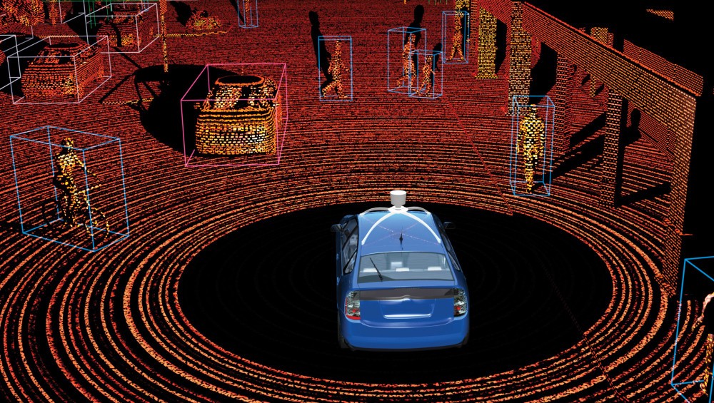
LiDAR plays a major role in autonomous vehicles, relying on a terrestrial LiDAR system to help them self-navigate. In 2018, reports suggest that the automotive segment acquired a business share of 90 percent. With self-driving cars inching toward mass adoption, expect to see major investments in LiDAR by automotive companies in 2021 and beyond.
As automotive companies look to make major investments in LiDAR, including Volkswagen’s recent investment in Aeva, many LiDAR companies are competing to create the go-to LiDAR system for automotive companies. Check out this great article by Wired detailing the potential for this bubble to burst.
LIDAR DRIVING ENVIRONMENTAL APPLICATIONS
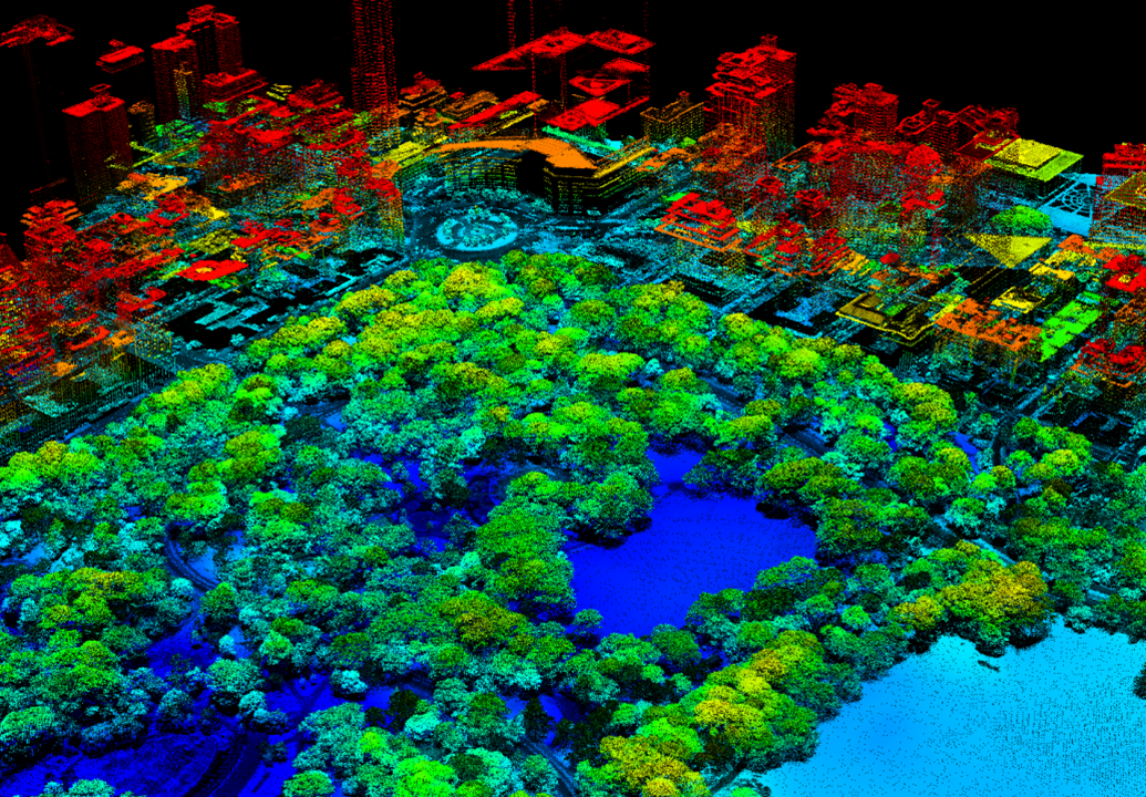
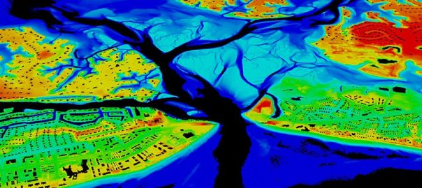
Beyond commercial applications and the automotive industry, LiDAR is gradually seeing increased adoption for geoscience applications. The environmental segment of the LiDAR market is anticipated to grow at a CAGR of 32% through 2025. LiDAR is vital to geoscience applications for creating accurate and high-quality 3D data to study ecosystems of various wildlife species.
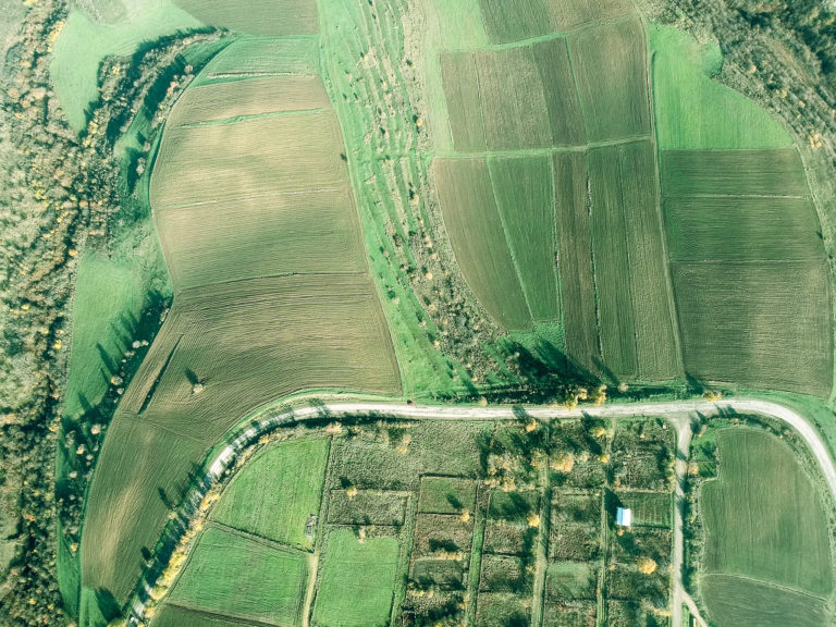
One of the main environmental uses of LiDAR is for soliciting topographic information on landscapes. Topographic LiDAR is expected to see a growth rate of over 25% over the coming years. These systems can see through forest canopy to produce accurate 3D models of landscapes necessary to create contours, digital terrain models, digital surface models and more.
CONCLUSION
In March 2020, after the first LiDAR scanner became available in the iPad Pro, The Verge put it perfectly when they said that the new LiDAR sensor is an AR hardware solution in search of software. While LiDAR has gradually found increasing usage, it is still a powerful new technology with burgeoning commercial usage. Enterprising app developers are looking for new ways to use it to empower consumers and businesses alike.
For supplementary viewing on the inner workings of the technology, check out this great introduction below, courtesy of Neon Science.