Tag Archives: Environment

How AI Fuels a Game-Changing Technology in Geospatial 2.0

Geospatial technology describes a broad range of modern tools which enable the geographic mapping and analysis of Earth and human societies. Since the 19th century, geospatial technology has evolved as aerial photography and eventually satellite imaging revolutionized cartography and mapmaking.

Contemporary society now employs geospatial technology in a vast array of applications, from commercial satellite imaging, to GPS, to Geographic Information Systems (GIS) and Internet Mapping Technologies like Google Earth. The geospatial analytics market is currently valued between $35 and $40 billion with the market projected to hit $86 billion by 2023.

GEOSPATIAL 1.0 VS. 2.0

geospatial

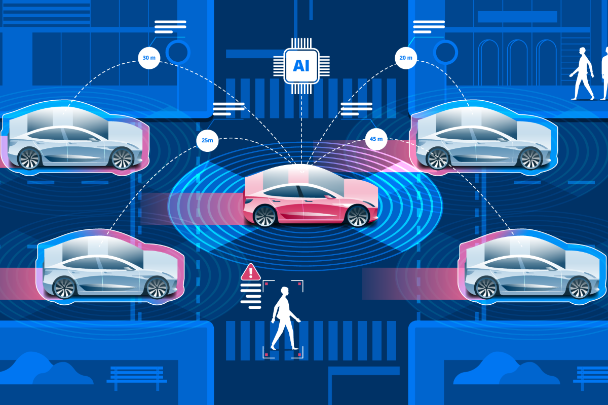
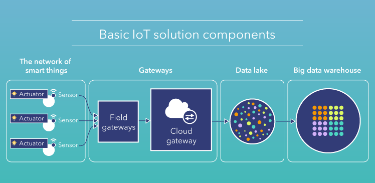
Geospatial technology has been in phase 1.0 for centuries; however, the boon of artificial intelligence and the IoT has made Geospatial 2.0 a reality. Geospatial 1.0 offers valuable information for analysts to view, analyze, and download geospatial data streams. Geospatial 2.0 takes it to the next level–harnessing artificial intelligence to not only collect data, but to process, model, analyze and make decisions based on the analysis.

When empowered by artificial intelligence, geospatial 2.0 technology has the potential to revolutionize a number of verticals. Savvy application developers and government agencies in particular have rushed to the forefront of creating cutting edge solutions with the technology.

PLATFORM AS A SERVICE (PaaS) SOLUTIONS

Effective geospatial 2.0 solutions require a deep vertical-specific knowledge of client needs, which has lagged behind the technical capabilities of the platform. The bulk of currently available geospatial 2.0 technologies are offered as “one-size-fits-all” Platform as a Service (PaaS) solutions. The challenge for PaaS providers is that they need to serve a wide collection of use cases, harmonizing data from multiple sensors together while enabling users to simply understand and address the many different insights which can be gleaned from the data.

shutterstock_754106473-768x576

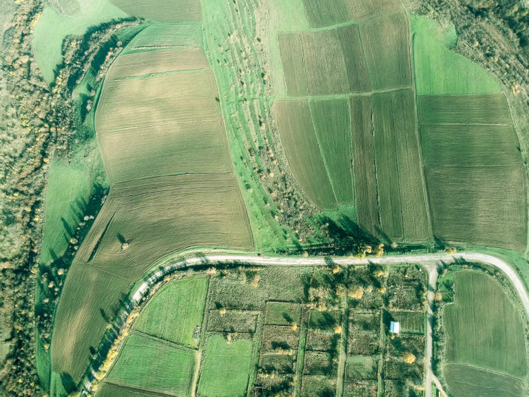
In precision agriculture, FarmShots offers precise, frequent imagery to farmers along with meaningful analysis of field variability, damage extent, and the effects of applications through time.

Mayday

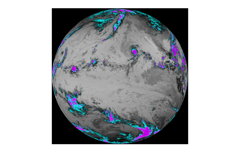
In the disaster management field, Mayday offers a centralized artificial intelligence platform with real-time disaster information. Another geospatial 2.0 application Cloud to Street uses a mix of AI and satellites to track floods in near real-time, offering extremely valuable information to both insurance companies and municipalities.

SUSTAINABILITY

The growing complexity of environmental concerns have led to a number of applications of geospatial 2.0 technology to help create a safer, more sustainable world. For example, geospatial technology can measure carbon sequestration, tree density, green cover, carbon credit & tree age. It can provide vulnerability assessment surveys in disaster-prone areas. It can also help urban planners and governments plan and implement community mapping and equitable housing. Geospatial 2.0 can analyze a confluence of factors and create actionable insight toward analyzing and honing our environmental practices.

As geospatial 1.0 models are upgraded to geospatial 2.0, expect to see more robust solutions incorporating AI-powered analytics. A survey of working professionals conducted by Geospatial World found that geospatial technology will likely make the biggest impact in the climate and environment field.

CONCLUSION

Geospatial 2.0 platforms are very expensive to employ and require quite a bit of development.  The technology offers great potential to increase revenue and efficiency for a number of verticals. In addition, it may be a key technology to help cut down our carbon footprint and create a safer, more sustainable world..

A Smarter World Part 3: How Smart Transportation Will Accelerate Your Business

In the last installment of our blog series on smart cities, we examined how smart infrastructure will revolutionize smart cities. This week, we will examine the many applications which will soon revolutionize smart transportation.

A smarter world means a faster, more efficient and environmentally-friendly world. And perhaps the biggest increase in efficiency and productivity will be driven by the many ways in which AI can optimize the amount of time it takes to get where you’re going.

Here are the top applications in smart transportation coming to a city near you:

Autonomous-vehicle-AdobeStock_174958313_rm

AUTONOMOUS VEHICLES

Some say autonomous vehicles are headed to market by 2020. Others say it could take decades before they are on the road. One thing is for certain, they represent a major technological advancement for smart transportation. Autonomous cars will communicate with each other to avoid accidents and contain state-of-the-art sensors to help keep you and your vehicle safe from harm.

Although autonomous vehicles are arguably the largest technological advancement on the horizon, they will also benefit greatly from a variety of smart transportation applications that will accelerate navigating your local metropolis.

Integrated-Roadways

SMART ROADS

What if we could turn roads into a true digital network, giving real-time traffic updates, supporting autonomous car technology, and providing true connectivity between vehicles and smart cities?

That’s the question tech start-up Integrated Roadways intends to answer. Integrated Roadways develops fiber-connected smart pavement outfitted with a vast amount of sensors, routers, and antennae that send information to data centers along the highway. They recently inked a 5 year deal to test out patented fiber-connected pavement in Colorado.

Smart Roads represent a major advancement in creating vehicle-to-infrastructure (V2I) connectivity. With 37,133 deaths from motor vehicles on American roads in 2017, the combination of AI applications in smart roads and autonomous cars could revolutionize vehicular transport and create a safer, faster world.

smart-traffic-lights-1_AMaJV_24429

SMART TRAFFIC LIGHTS

The vehicle-to-infrastructure connectivity spans beyond the roads and into the traffic light. Idling cars generate an estimated 30 million tons of carbon dioxide. Traffic jams can make it harder for first responders to reach emergencies. Rapid Flow proposes that the answer may be their AI-based adaptive traffic management system called Surtrac.

Surtrac uses a decentralized network of smart traffic lights equipped with cameras, radar, and other sensors to manage traffic flows. Surtrac’s sensors identify approaching vehicles, calculate their speed and trajectory, and adjust a traffic signal’s timing schedule as needed.

red line bus

SMART PUBLIC TRANSIT

There are a variety of smart applications which are revolutionizing public transportation.

In Singapore, hundreds of cameras and sensors citywide analyze traffic congestion and crowd density, enabling government officials to reroute buses at rush hour, reducing the risk of traffic jams. In Indianapolis, the electric Red Line bus service runs a 13 mile path that travels within a quarter of a mile of roughly 150,000 jobs.

One of the major disruptors which has seen rapid adoption in the smart public transport are electric scooter sharing services like Bird and Lime. Electric scooters fill in the public transportation gap for people looking to go 1-3 miles without having to walk or take a taxi. Electric scooters have seen adoption in Los Angeles, San Francisco, Salt Lake City, Brooklyn, and more cities around the globe.

CONCLUSION

Smart cities will have a host of revolutionary applications working in unison and communicating through smart infrastructure with municipalities to ensure maximum efficiency and safety when it comes to transportation. In our next installment of our series on smart cities, we’ll examine how smart security will help keep city-dwellers safe.

A Smarter World Part 2: How Smart Infrastructure Will Reshape Your City

Imagine a city that monitors its own health, identifies potential fail points using AI algorithms, and autonomously takes action to prevent future disasters.

This is the smart-city of the future. In our first installment of our blog series on Smart Cities, we ran through an overview of how Smart Cities will change our world. In this second entry of our blog on smart cities, we’ll examine perhaps the biggest building block necessary to create a smart city: smart infrastructure.

The construction of a smart city begins with developing a vast, city-wide IoT system, embedding sensors and actuators into the infrastructure of the city to create a network of smart things. The sensors and actuators collect data and send it to field gateways which preprocess and filter data before transmitting it through a cloud gateway to a Data Lake. The Data Lake stores a vast amount of data in its raw state. Gradually, data is extracted for meaningful insights and sent to the Big Data warehouse where it’s structured. From here, monitoring and basic analytics will occur to determine potential fail points and preventative measures.

Check out the breakdown below:

Breakdown

As you can see, it all begins with the construction of smart infrastructure that can collect data. Here are some of the big applications in the smart infrastructure space:

STRUCTURAL HEALTH

One of the major applications of smart infrastructure will be monitoring key data points in major structures, such as the vibrations and material conditions of buildings, bridges, historical monuments, roads, etc.

Cultivating data will initiate basic analysis and preventative measures, but as we gather more and more data, AI and machine learning algorithms will learn from vast statistical analysis and be able to analyze historical sensor data to identify trends and create predictive models to prevent future disasters from happening with unprecedented accuracy.

Learn more about how Acellant is building the future of structure health monitoring.

ENVIRONMENTAL APPLICATIONS

There are a multitude of potentially environmental applications for smart infrastructure designed to optimize city activities for environmental health. For example, embedding street lights with intelligent and weather adaptive lighting will reduce the amount of energy necessary to keep roads alight.

Air pollution monitoring will help control CO2 emissions of factories and monitor the pollution emitted by cars. Ultimately, earthquake early detection can help monitor distributed control in specific places of tremors.

2017-05-08-151015.975562trashcity

WASTE MANAGEMENT

Boston is well-known as one of the top college cities in the United States. Every fall, over 160,000 college students from MIT, Harvard, Northeastern, BU, BC, Berklee School of Music, and more move in to their new living spaces, causing undue stress on the city’s waste management administration. ANALYZE BOSTON, the city’s open data portal, provided key data points such as housing rentals, trash volume and pick-up frequency, enabling a project called TRASH CITY to reroute waste management routes during this trying time.

CONCLUSION

Projects like Trash City show the many ways in which we can optimize city operations by analyzing data effectively. As smart infrastructure enables the collection of more and more data, projects like TRASH CITY will become more efficient and more effective.

Of course, the biggest application of Smart Infrastructure will be the many ways in which it will change how you get from A to B. Next week, we’ll focus in on smart transportation and how it will reshape metropolitan transportation.

Securing Your IoT Devices Must Become a Top Priority

The Internet of Things has seen unprecedented growth the past few years. With an explosion of commercial products arriving on the marketplace, the Internet of Things has entered the public lexicon. However,  companies rushing to provide IoT devices to consumers often cut corners with regard to security, causing major IoT security issues nationwide.

In 2015, hackers proved to Wired they could remotely hack a smartcar on the highway, kill the engine and control key functions. Dick Cheney’s cardiologist disabled WiFi capabilities on his pacemaker, fearing an attack by a hacker.  Most recently, the October 21st cyber attack on Dyn brought internet browsing to a halt for hours while Dyn struggled to restore service.

Although the attack on Dyn seems to be independent of a nation-state, it has caused a ruckus in the tech community. A millions-strong army of IoT devices, including webcams and DVRs, were conscripted with a botnet which launched the historically large denial-of-service attack. Little effort has been made to make common consumers aware of the security threats posed by IoT devices. A toy Barbie can become the back door to the home network, providing access to PCs, televisions, refrigerators and more. Given the disturbing frequency of hacks in the past year, IoT security has come to the forefront of top concerns for IoT developers.

SECURING CURRENT DEVICES

The amount of insecure devices already in the market complicates the Internet of Things security problem. IoT hacks will continue to happen until the industry can shrink vulnerable devices. Securing current devices is a top priority for app developers. Apple has made an effort to combat this problem by creating very rigorous security requirements for HomeKit compatible apps.

The European Union is currently considering laws to force compliance with security standards. The plan would be for secure devices to have a label which ensures consumers the internet-connected device complies with security standards. The current EU labeling system which rates devices based on energy consumption could prove an effective template for this new cybersecurity rating system.

ISPs COULD BE THE KEY

Internet service providers could be a major part of the solution when it comes to IoT Security. Providers can block or filter malicious traffic driven by malware through recognizing patterns. Many ISPs use BCP38, a standard which reduces the process hackers use to transmit network packets with fake sender addresses.

ISPs can also notify customers, both corporate and individuals, if they find a device on their network sending or receiving malicious traffic. ISPs already comply with the Digital Millennium Copyright Act which requires internet providers to warn customers if they detect possible illegal file sharing.

With the smarthome and over 1.9 billion devices predicted to be shipped in 2019, IoT security has never been a more important issue. Cyber attacks within the US frequently claim the front page of the mainstream media. CIO describes the Dyn attacks as a wake-up call for retailers. The combination of a mass adoption of IoT and an environment fraught with security concerns means there will be big money in IoT security R & D and a potential slow-down in time-to-market pipeline for IoT products.

Will the federal government get involved in instituting security regulations on IoT devices, or will it be up to tech companies and consumers to demand security? Whatever the outcome, this past year has proved IoT security should be a major concern for developers.